

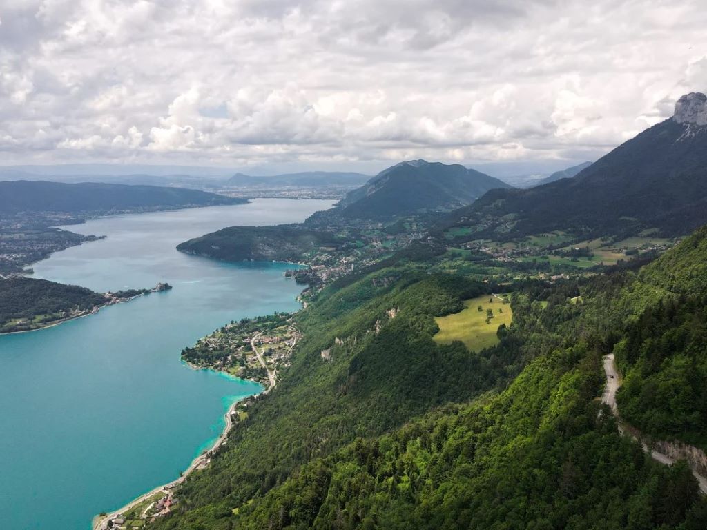
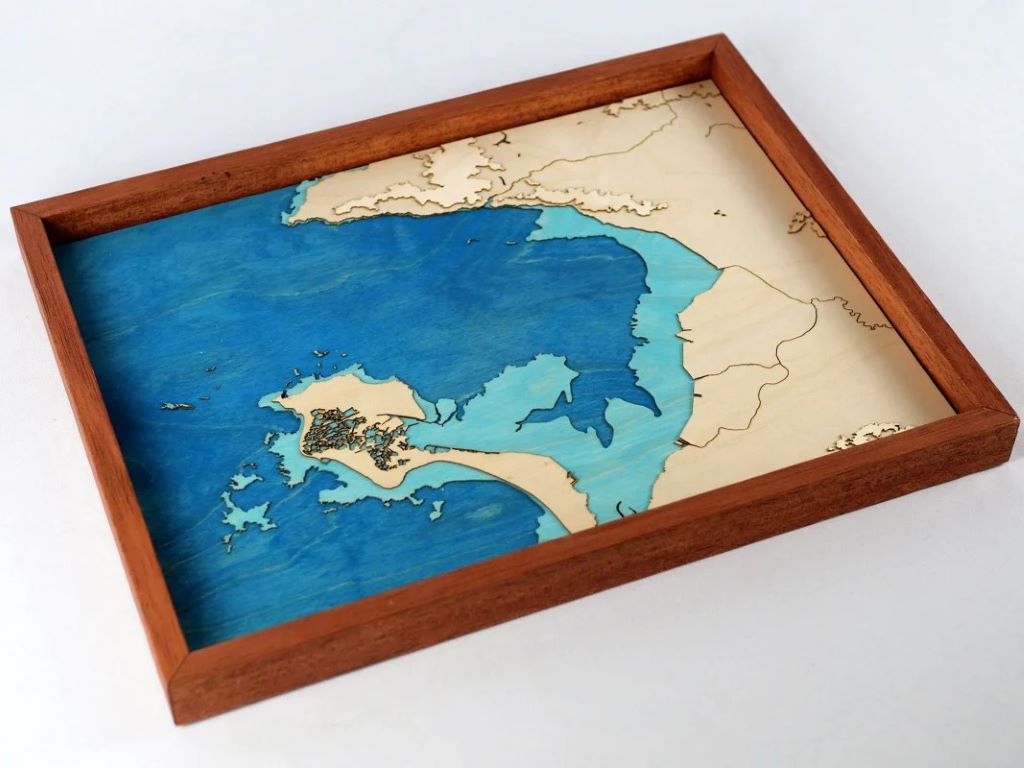
The magnificent setting of Lake Annecy is surrounded by mountain ranges that seem to protect it. We have recreated their unique relief in a topographic wooden map that will remind you of wonderful memories of the region.
You will find the Bauges massif to the West (with the Roc des Boeufs and the Semnoz, a local favorite) and the Bornes massif to the East (with the steep Dents de Lanfon, La Tournette with its chair-like shape, and Mont Baron adjacent to Mont Veyrier). To the north, Annecy occupies the plain, and we have carefully included the Swan Island (which is actually artificial) despite its small size.

Cycling enthusiasts and flat terrain lovers are not forgotten; the shores of the lake are famous for their peaceful walks, and we have meticulously represented them using the ultra-precise data from the IGN (French National Geographic Institute). Notice how the photo and the map correspond, and you too can find the spots you love.
We chose to illustrate it in turquoise blue as a tribute to Cézanne and his famous painting of the blue lake, but also to the purity and gentleness of the water.
In total, the map consists of 22 layers each 1 millimeter thick, covering nearly 2000 meters in elevation. It's the largest we've made so far, and probably the most beautiful too.


Leave a comment
All comments are moderated before being published.
This site is protected by hCaptcha and the hCaptcha Privacy Policy and Terms of Service apply.