
"BOILISÉ is above all a way to illustrate one's little corner of paradise."
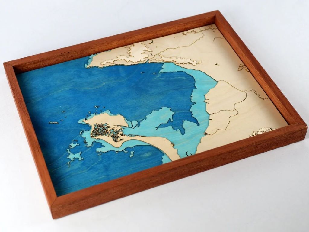
These words from an interior decorator inspired us to add the Bay of Bourgneuf and the Island of Noirmoutier to our catalog, despite their almost non-existent relief!
To achieve this, we had to innovate: we retrieved the land-sea boundary data from the IGN and used the areas submerged at high tide as a layer in their own right. To enhance the depth effect, we chose to assign them the turquoise blue tone usually available as an option, making them stand out against the navy blue of the Atlantic Ocean.
On the coast, the ports of Pornic, Moutiers-en-Retz, or Barre-des-Monts naturally stand out. The marshes of Noirmoutier, among the few considered as bodies of water by the IGN, give a lace-like appearance to this famous island. Then the Falleron and the Haute Perche canal stripe this flat country of Retz.
Technically not quite flat, but even with 0.8mm thick wood, it was impossible to highlight the highest point of the Princé forest at 241m (northeast of the map) without cheating. That's what we decided to do to give the map extra soul and not to upset those who, for example, find the streets of Pornic not so flat. The relief layer has been slightly exaggerated.
In the end, the result is beyond our expectations. With its elegant design and reduced price, this map will make the perfect Christmas gift for all lovers of the Retz region!
And we will be adding other Atlantic regions in the coming weeks!

Leave a comment
All comments are moderated before being published.
This site is protected by hCaptcha and the hCaptcha Privacy Policy and Terms of Service apply.