
A new Auvergne menu joins the BOILISÉ catalog, once again to meet the request of a lover of the region. This is Puy-en-Velay and its surroundings!
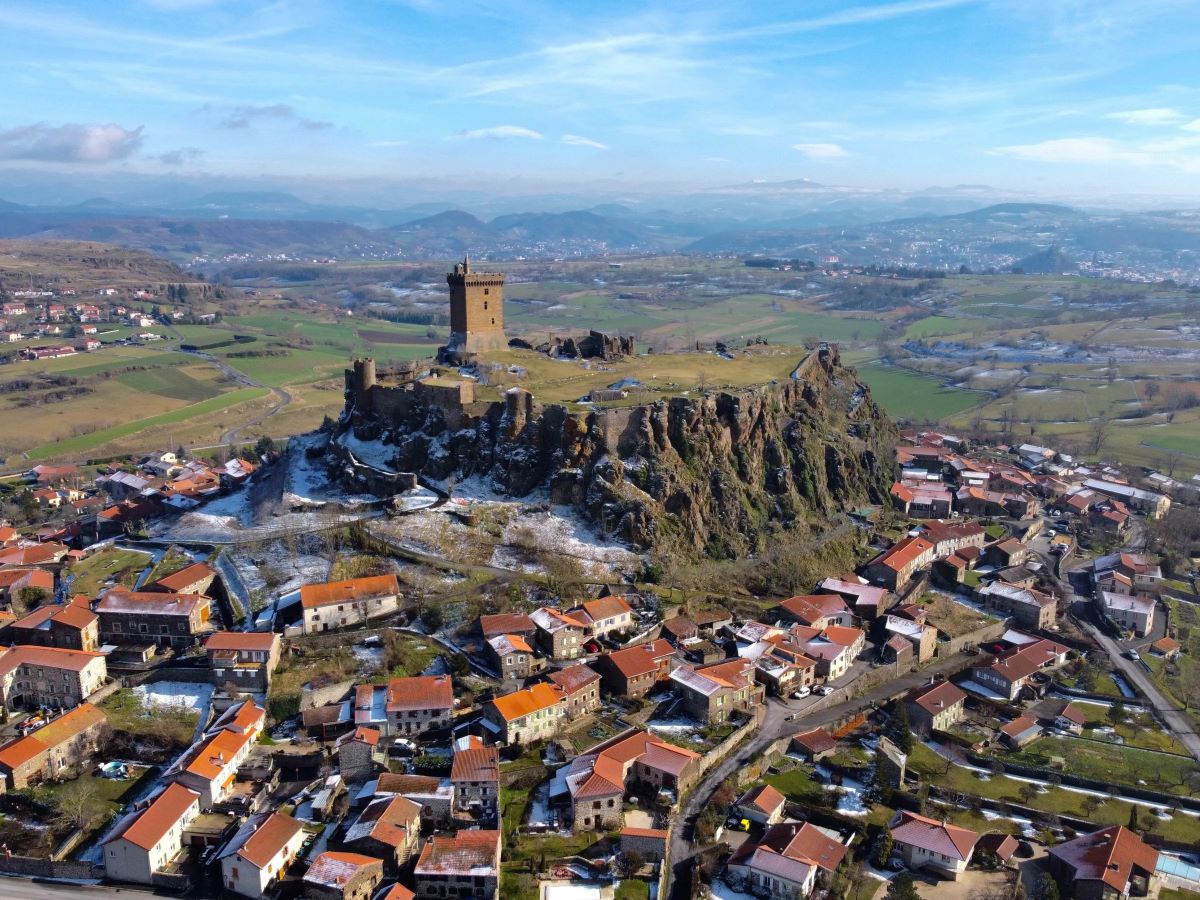
The wooden topographic map and its precision highlight the particular relief of the Puy basin.
Geography and topography of the Puy basin
Located at the confluence of the Borne and Loire valleys at an altitude above 600m, it has numerous hillocks and plateaus of various shapes. The Loire valley widens greatly before collapsing into gorges between Chadrac and Lavoûte-sur-Loire.
The basin is dominated by stepped plateaus with steep edges and in the middle of the clearest depressions emerge peaks such as the basalt base which serves as a pedestal for the majestic fortress of Polignac or the Corneille rock which stands out from the town of Puy-en -Velay from the top of its 757m.

The history of the topography of Velay is similar to that of the Massif Central and this map resembles that of the Chaîne des Puys. A major volcanic episode in the form of flows, eruptions and caldera formations shaped the region.
We can distinguish by their rounded shape and multiple layers of wood the main peaks popular with hiking enthusiasts: Mont Denise, Suc Chauven, Suc de la Conche, Mont Serre and even Say.
The small towns and villages around Puy-en-Velay will require an effort to identify using the rivers (Loire, Gagne and Borne), the bodies of water (Grand lac, Plan d'eau d'Orzilhac) and the relief but we will easily find: Brives-Charensac, Polignac, Coubon, Ceyssac, Chaspinhac and Saint-Christophe-sur-Dolaison.

The typically Auvergne volcanic relief seduces us each time with the purity of its lines and the variety of its shapes.
Whether you are a ponot, a jaquet (having started from via Podensis to go to Santiago de Compostela), inhabitant of a small village like Brestilhac or simply in love with the region, you can proudly display it to decorate your interior and share your story with your guests.
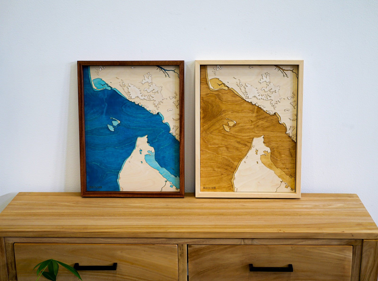
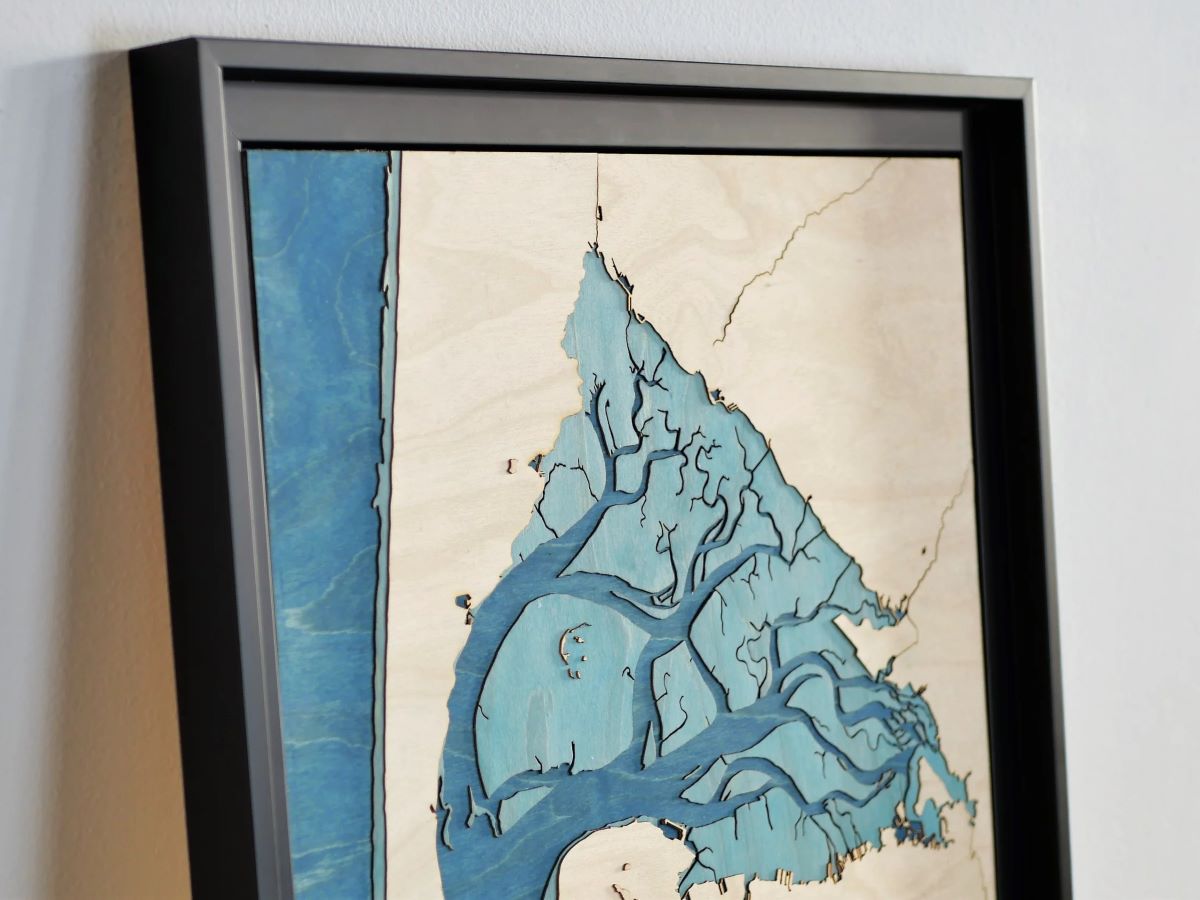
You will note the depth of the painting and the elegance of its reflections changing with the light.

Technical details of the wooden board
The table measures 40cm in height and 30cm in width, it is made up of 13 levels of 0.6mm birch sheets, each laser cut with precision. In total, we assembled nearly 180 pieces and worked more than 10 hours to complete this unique work.
All the relief is to scale (1 millimeter table corresponds to 75 meters of land), it is as if you were flying over the region in an airplane but you can also touch it and feel the slight roughness of the wood.

On the North-South axis, nearly 30 km are covered and there is a 560 meter difference in altitude between Suc de Miceselle (1097m, at the very south of the map) and Saint-Vincent (at the very north).
We deliver it ready to install with a brass rope which allows it to be easily centered.
The product
To access the product page, click on the image below:

Leave a comment
All comments are moderated before being published.
This site is protected by hCaptcha and the hCaptcha Privacy Policy and Terms of Service apply.